Map
About this learning resource
Format: PDF
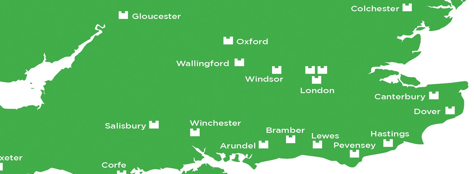
A map with Norman Castles plotted on it to show the extent of William’s castle building across England in the Norman period.
This resource supports the Key stage 3 1066 and the Norman Tower of London school session at the Tower of London.
National Curriculum links
• The development of Church, state and society in Medieval Britain 1066-1509.
• KS4 and KS5 Normans.
Learning objectives
• Students will explore castle and castle-building as a key aspect of Norman rule.
• Students will understand the key people who impacted on the reigns of William I and his sons.
Resource Information
Key Stage
- KS3 (age 11-14)
- KS4 (age 15-16)
- KS5 (age 16+)
Subjects
- History
- Geography
Topic
- Normans
- Castles
Type
- Biographies & Fact sheets
- Images
- Timelines
Palace
- Tower of London

In this episode, students learn to spot key Tudor building features such as timber framing, red Tudor bricks and wattle and daub. They’ll also discover how the Great Fire of London changed the way people built homes.

Explore religion, power, and conflict in Tudor England through this immersive 360° virtual tour of the Tower of London, focusing on the Beauchamp Tower, its prisoners, and their graffiti. Perfect for KS3.

Download ready-to-use Henry VIII six wives resources, including fact sheets, biographies and timelines. These free, editable resources introduce each queen as a historical figure in her own right - going beyond the familiar rhyme of “divorced, beheaded, died”.